
![]()
What is it?
(from Wikipedia) ArcGIS is a geographic information system (GIS) for working with maps and geographic information. It is used for: creating and using maps, compiling geographic data, analyzing mapped information, sharing and discovering geographic information, using maps and geographic information in a range of applications, and managing geographic information in a database.
What is available?
The University has subscribed to an annual site license for ArcGIS via an Eduserv CHEST agreement. The agreement includes use of ArcGIS Pro and a wide range of extension licences as well as access to the online SaaS environment ArcGIS Online.
There is a Windows version, but not one for MacOS. ESRI suggest it can be run on Mac under either Bootcamp or Parallels.
Who can have it?
Academic use on and off campus by staff and students. Unusually for these agreements, there is also some use allowed for administrative use of the product, e.g. by Estates and Facilities.
Restrictions
- Use is not allowed outside of the UK or the Republic of Ireland
- Use of Esri software is subject to the Licence Terms and Conditions
How can I get it?
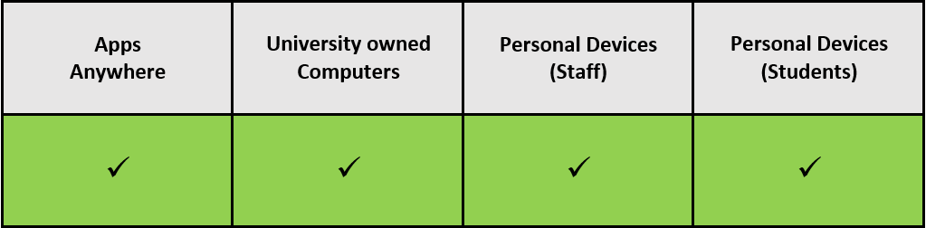
- ArcGIS Pro
- Live from Apps Anywhere
- Request install to University Computer from DTS Service Desk
- Downloadable from ArcGIS Online (see below)
- ArcGIS Online
- Log in to the University’s organisation https://uordg.maps.arcgis.com/ – select UoR Login and log in as normal using UoR Microsoft account.
What support/training is available?
- Please see the CHEST page on Services and Support for further information.
When does the license/agreement run till?
- The license is renewed annually on 1st August
- The agreement runs from 1st August 2023 to 31st July 2026. A decision to renew the agreement will be taken in good time.